Boston, Massachusetts, Stati Uniti


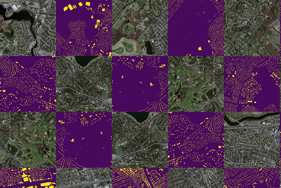
This dataset consists of 151 aerial images of the Boston area, with each of the images being 1500 x 1500 pixels for an area of 2.25 square kilometers. Hence, the entire dataset covers roughly 340 square kilometers. The data is split into a training set of 137 images, a test set of 10 images, and a validation set of 4 images. The target maps were obtained by rasterizing building footprints obtained from the OpenStreetMap project. The dataset covers most urban and suburban areas and buildings of all sizes, including individual houses and garages, are included in the labels. All imagery is rescaled to a resolution of 1 pixel per square meter. Target maps for the test and validation portions of the dataset were hand-corrected to make the evaluations more accurate.